Changing the perception, one bay at a time…
The sub pages will eventually contain details regarding Carolina bays which fit the bayCarolina archetype shape.
The initial library contains bays from the USGS Florence_W and Florence_E 1º quadrants. Here are three downloads which will help facilitate indexing these bays geospatially using Google Earth.
First is a kmz collection of 32 1/4º LiDAR DEM tile sets which visualize on Google Earth: LINK , but don't bother unless you have a relatively fast link (or be real patient as the LiDAR loads).
Second is a kmz collection which presents all 15,000 Carolina bay formations in the Florence footprint: LINK
Third is a kmz file that has exclusively placemarks for ~545 bays which meet a special criteria; specifically of "high quality" and larger than 800 meters on the long axis: LINK. This kmz provides a geospatial index to those bays which appear in the initial 500 bay web-based visualization deployment, and works well with the lightweight version of Google Earth on desktops with Chrome, and on mobile devices with the Google Earth app. Each placemark in this KMZ provides a popup with metrics and a hyperlink to load the bay's slider web page directly.
And finally, the interactive map below offers direct access to each of those 545 bays using the link in a selected bay's popup information window. Select the "View larger Map" icon in upper right corner to enlarge this map to a new web page.
The image below shows the index display accessed using the Google Earth application.
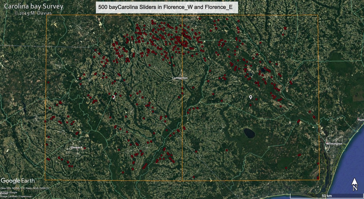
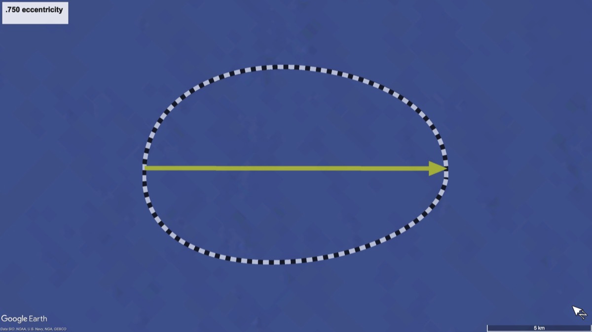
There are over 26,000 bays which match the bayCarolina archetype; ~15,000 of which reside within two USGS quadrants: Florence_W and Florence_E. All bays we have registered in the Survey of those two quadrants conform to the exact shape below, differing only by the eccentricity (a function of major axis vs minor axis). The eccentricity reaches unity (1.0) when it is stretched out to a straight line, while it reaches zero the the bay conforms to a circular basin. The image below is an exact replica of the png graphic image file (bayCarolina.png) that is referenced when viewing in Google Earth, and differs in each bays over a range of eccentricities from ~0.55 to ~0.85.
Here are some quick links to subsets of the bay imagery.